During this year’s I/O keynote, Google announced a new version of Maps for the web.
Shown off on a Chromebook Pixel, Google touted a number of modern web technologies such as WebGL in the new app. Even though the old maps also made use of WebGL, said to offer a “richer maps experience with immersive 3D buildings, smoother transitions between imagery, fluid transitions into Streetview and more”, the next version of Maps builds upon that.
Even though the next version of Maps is still in its testing stages, I still felt it worth highlighting some of the changes you’ll see when it rolls out for all later this year.
New Google Maps Overview
Straight away, you can see that Google has cleared away all the clutter from the Maps home page.
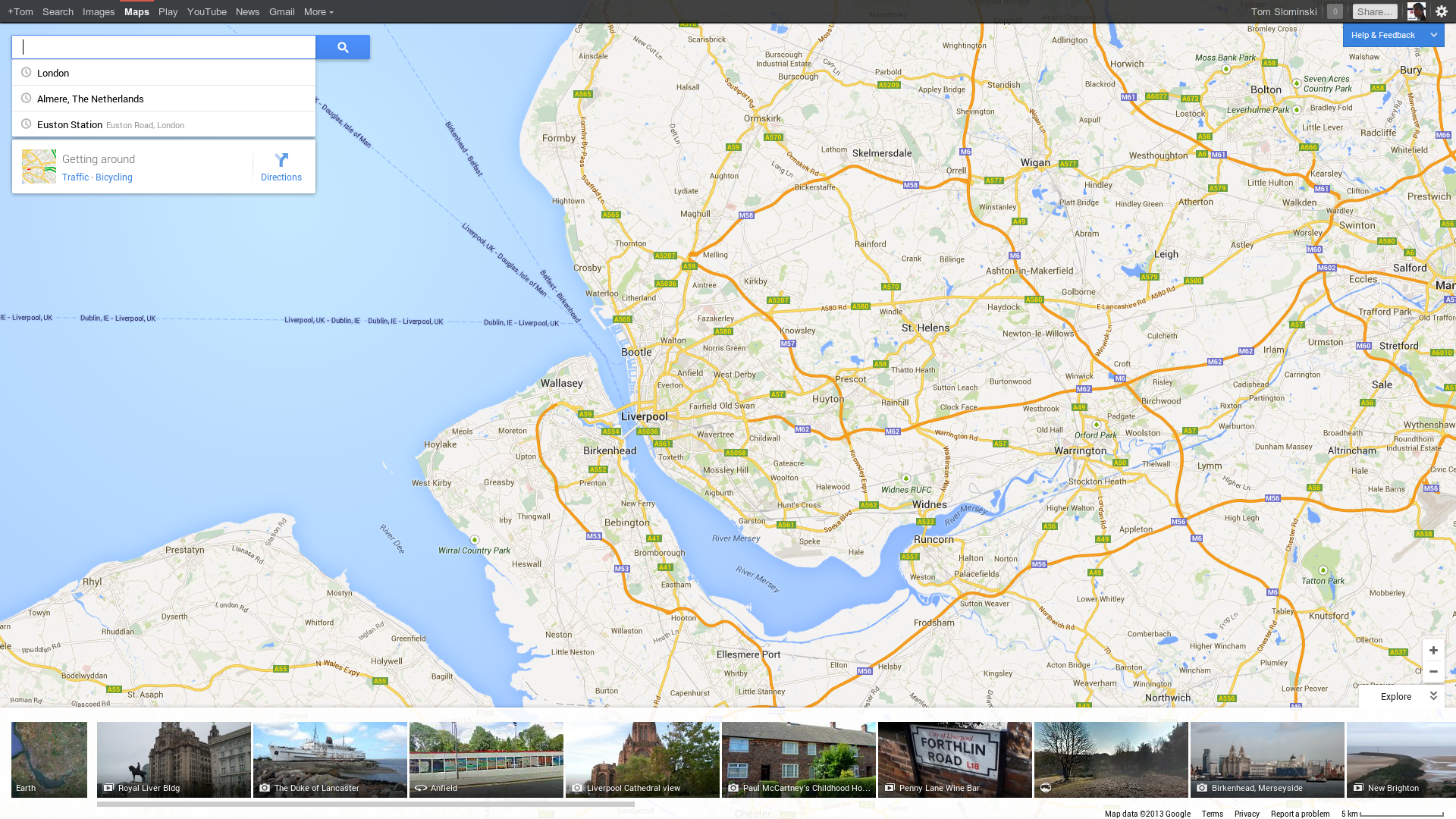
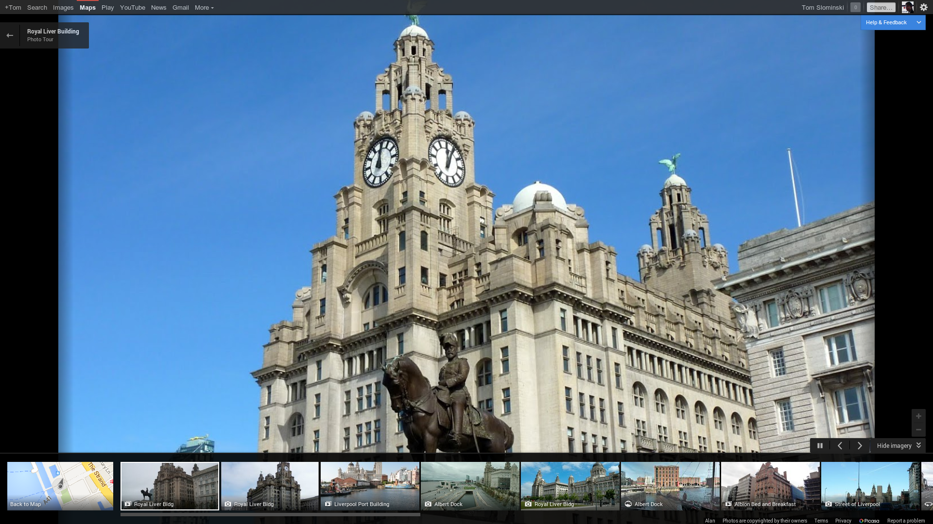
The thick, white sidebar is gone, replaced by a small search box in the corner. The focus on the map itself is clear, and below the map is a list of popular places in the area on your screen.
The list contains pictures, photospheres and slideshows of the most popular places in the area. Whereas pictures and photospheres work as expected, the slideshows are a little bit more fun than usual.
Google seems to recognise similar points in pictures and then use them to transition between pictures. It looks much better than a normal slideshow.
While I haven’t yet seen any slideshows designed specifically to take advantage of this feature, there’s plenty of opportunity for greatness.
Searching for something displays the most important results as big icons on the map, with the lesser results as small red dots. Your favourites receive a gold star icon.
Clicking on a destination reveals more information about it below the search bar and highlights the roads you might want to take from your current destination on the map. As previously, searches are synchronised with Google Now for quick access on your other Google devices.

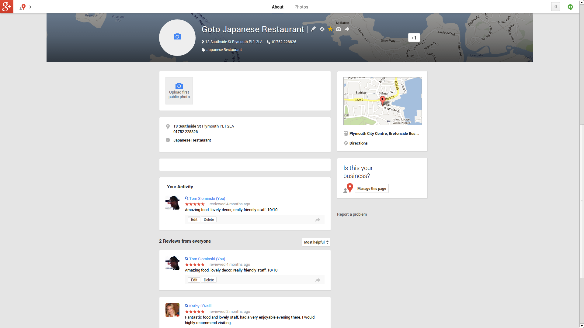
Clicking on the reviews link of a result brings the familiar Google+ Local page. It includes information about the place, reviews from around the web etc.
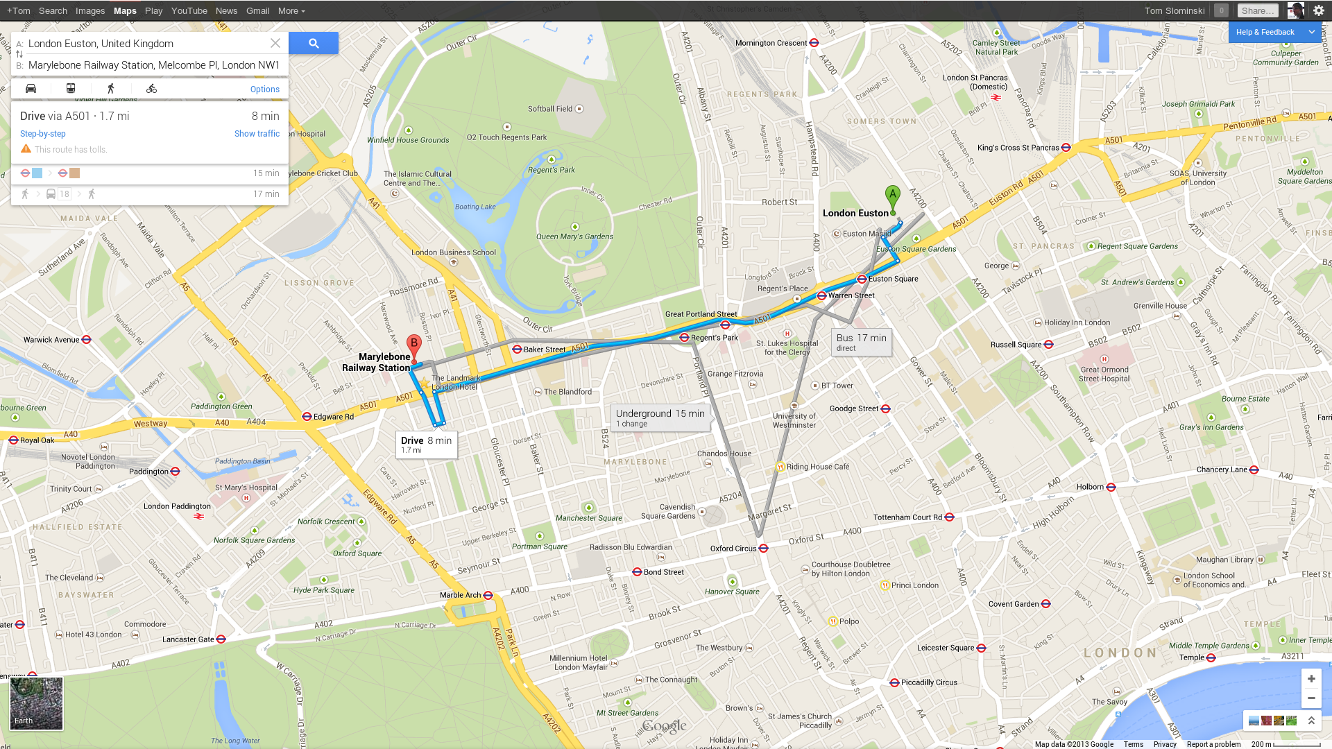
Upon asking for directions (either by using the traditional directions button, searching for something like ‘Euston station to Marylebone station’ or clicking on a destination and then your home) Maps now shows multiple methods you can take, along with useful info for specific methods of transport, like distances for car journeys and whether your bus journey is direct or not.
You no longer need to select how you want to travel, as Google shows you all the choices and recommends the best one.
Upon clicking on a rail or underground station, Maps show all the lines connected to it. It’s quite a handy feature.
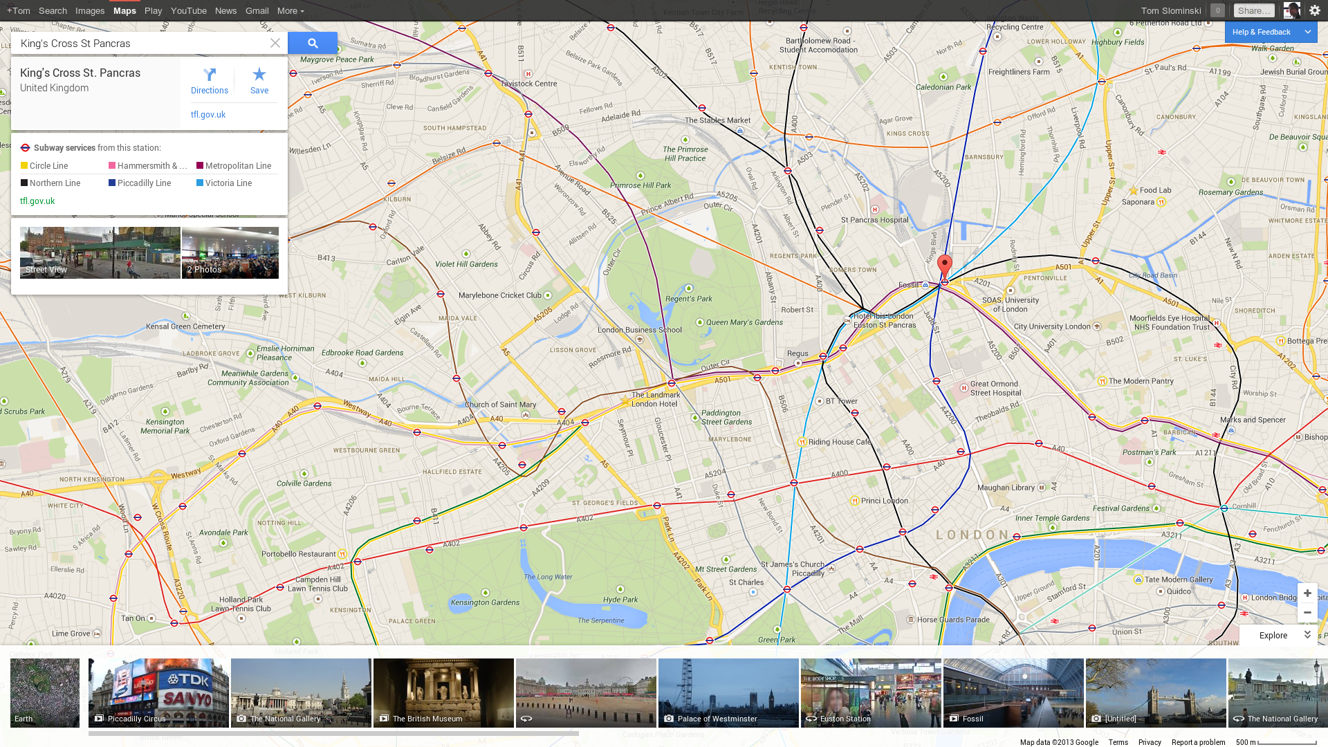
In case the map is not giving you enough information, Maps now show a bigger public transport information screen (as opposed to cramming all that information in the sidebar in the old Maps).
You can view various journeys throughout the day, information about transfer and order tickets from affiliated sites. Similar screens are also available for other types of transport, however they don’t offer as many options for changing how you’re going to get to your destination.

Even though you can’t do much in the map view other than move about and zoom in and out, you do have some control in the earth view. You can tilt the map and rotate the map by 90 degrees using the navigation buttons in the bottom right corner.

Most people would class this as a gimmick, but it’s quite fun to play around with. If you zoom out far enough, Google Maps now show you clouds in real time. In this unique instance, there aren’t any over the UK ;)
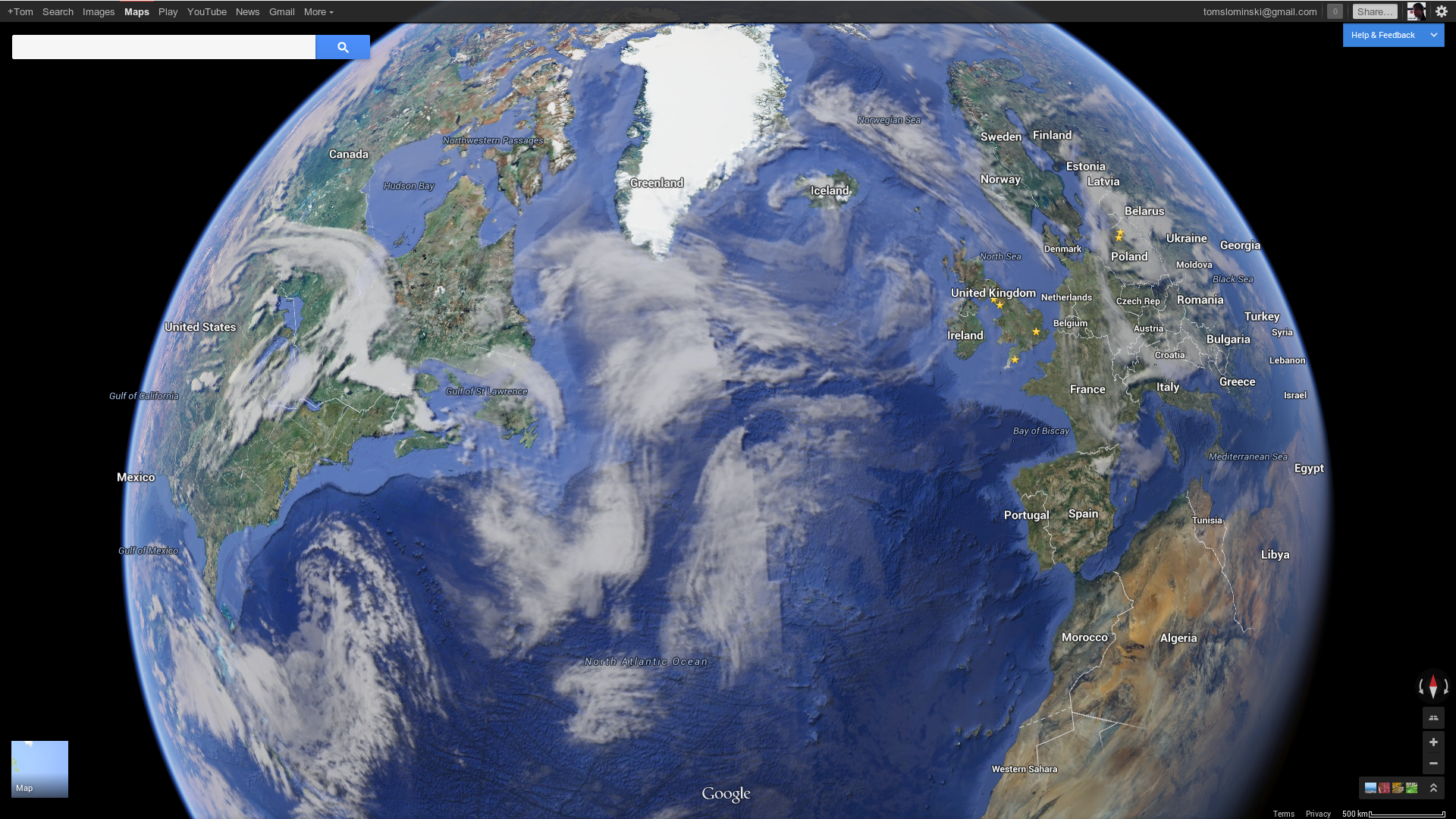
And if you zoom out even further, you get a beautiful view of the earth, which will be familiar to users of Google Earth. You can spin it freely and see on which side of the Earth light falls on right now.
Google says the stars in the background are also real time.

Lacking
Sadly, Google Maps is still missing some features familiar to Android users.
For example, I expected to be able to see 3D buildings rise out of the ground when I zoom into supported areas, or to be able to browse individual floors of the London Euston train station. These are both features available in the Android Maps app, but not yet available here.
However, it is clear that the new web version of Maps is now more than capable of supporting features like these. Maps feel clearer and smoother and features feel smarter than before. It is a leap in the right direction.
Want to experience the new Maps for yourself? Register for an invite here.